Name: El Volcán Santiaguito
Location: Quetzaltenango, Guatemala
Altitude: Variable, but estimated to be about 2,510m / 8,235 ft (1)
Difficulty: Challenging
View: Otherworldly
Recommended: Only for those fit for hiking.
Volcanic Activity: Very Active
History and Formation:
On October 25, 1902 the volcano Santa María erupted violently, destroying much of the surrounding area in Quetzaltenango, Guatemala. Following about 20 years of relative inactivity its crater had collapsed in on itself and a new escape was formed on its SW side. This new volcano was named Santiaguito and its first recorded eruption took place in June of 1922 and it has been constantly active since then (2). According to our hiking guide, the crater has changed position 4 times already and it is still evolving as the volcano comes into its own (3).
My Opinion:
I had already hiked many mountains and volcanoes in Guatemala, but for some reason the trip to the crater of Santiaguito always seemed to elude me: I was too busy studying and preparing for exams, bad weather conditions made hiking too dangerous, lack of interest from other hikers made it so the hike would be too expensive, etc… so when the opportunity finally presented itself after more than 2 years of waiting I took it, and I must say I was not disappointed!
Without question, this was one of my favorite hikes of all time! Walking around and down one volcano with the goal of climbing another and camping near its erupting crater may sound ridiculous to most, but for me it was an unforgettable, adrenaline-fueled adventure which I will never forget.
The hike, at least in my eyes, can be broken down into 3 or 4 parts, depending on how adventurous you choose to be…
Part 1: Hiking to El Mirador Santiaguito
The first part of the hike is exactly the same as the trip to El Mirador Santiaguito which I have also written a blog post about, the only exception being that we began slightly earlier in the morning. Please click here to learn more about El Mirador Santiaguito and this section of the hike.
Part 2: From El Mirador to the Beach
After a quick break to eat breakfast and watch Santiaguito erupt, we packed up or gear and began the 3 hour descent down the SW side of Santa María towards the base of Santiaguito and the “beach”, an area which from above looks almost like a nice beach formed from years of erosion and fallen ash, but from up close appears to be nothing more than a rock farm.
The first half of the descent was steep and at times quite narrow with lots of vegetation and cow poop to guide our trail. We followed a wide crack in the volcano and once possible jumped into the rocky valley where we rested and hydrated ourselves. The second half saw us slipping and sliding (literally) our way down well polished rocks before finally reaching the “beach” and breaking for lunch. The sliding was one of the more playfully childish parts of the hike, but was also an efficient, quick, and safe way to get down. Definitely give it a go : )
Part 3: Hike to Base Camp
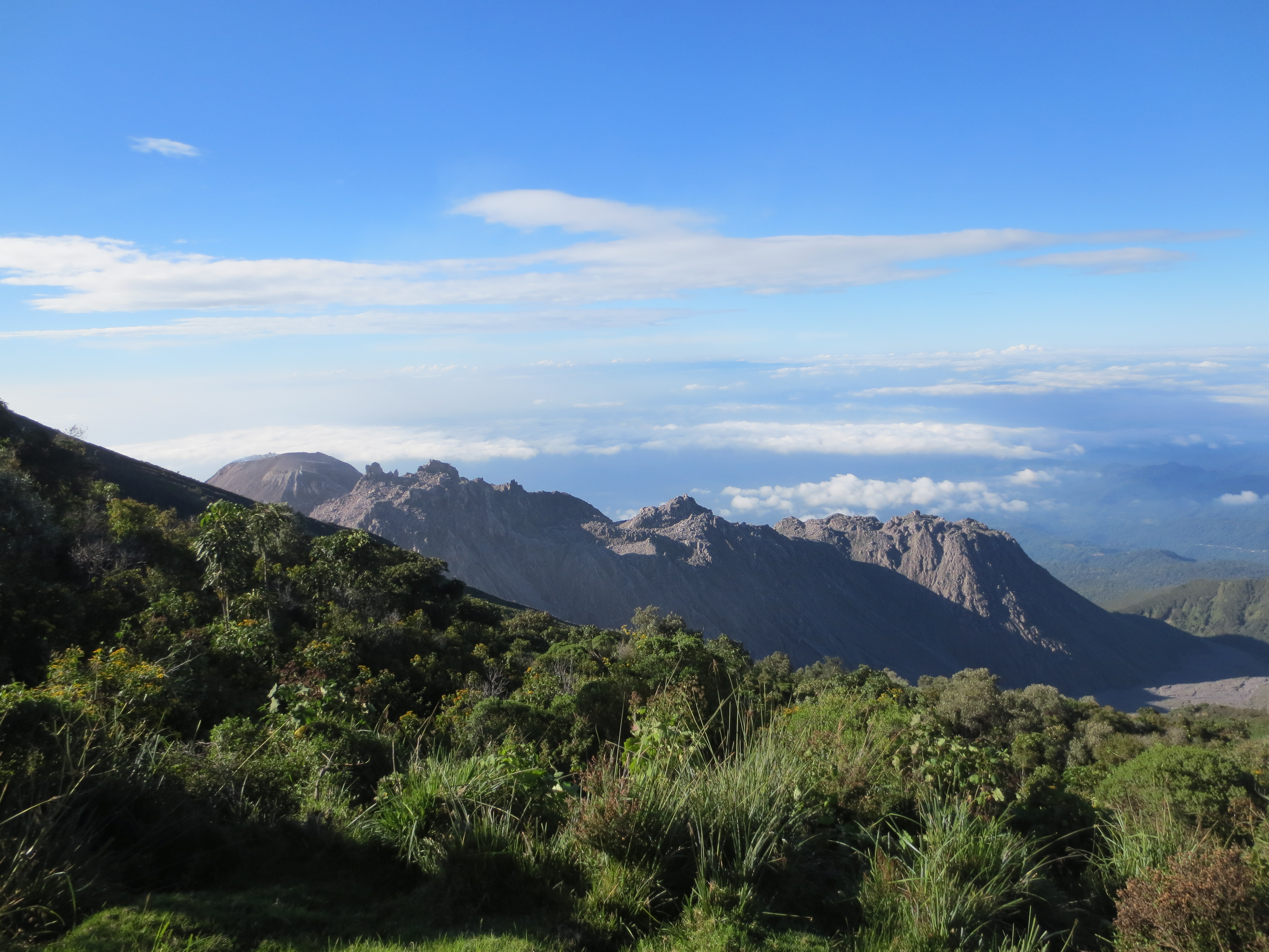
While not especially technical, the next 2.5 hours were a bit tough. With no shade and the sun beating down on us, we climbed that rocky staircase until reaching level ground and I was pretty surprised at what I saw: lots of vegetation, small vents releasing piping hot steam (good for cooking!), and a large flat area of grayish sand which felt like moon dust to touch. It was a pretty otherworldly experience, and as the guide told us we were standing on the original crater site!!! We continued to hike up another 20 minutes or so and set camp. The view was incredible: we had Santiaguito in front of us, the broken face of Santa María just to the left of and behind Santiaguito, and a view of the coastal lands to the right… not a bad place to spend the night!!!
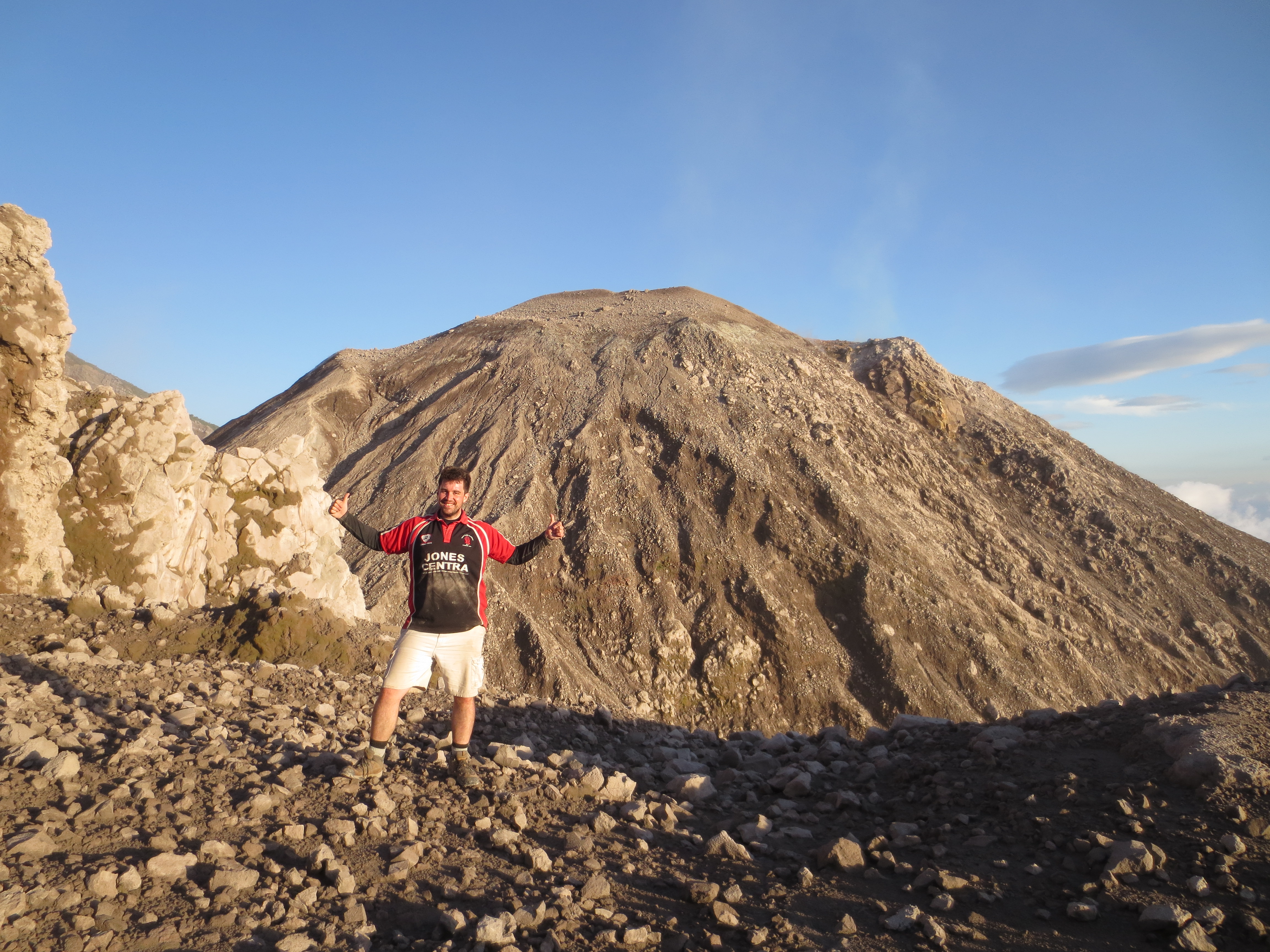
Part 4: Optional Climb to Crater
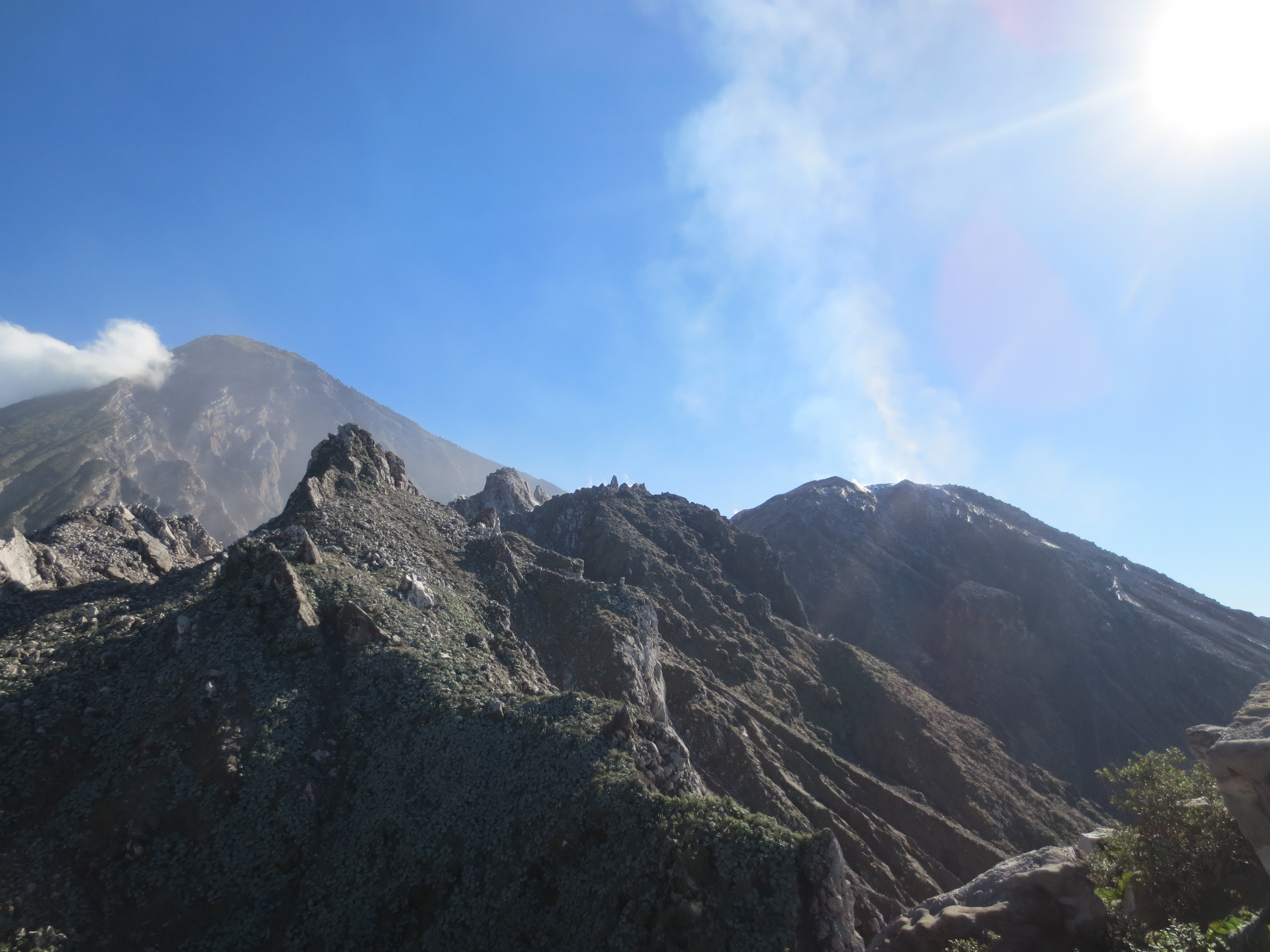
This is where the real fun began… after setting up camp we took off again, climbing closer and closer to the crater. We reached the second crater site after about 45 minutes. The ground was flat, hard and pristine… as if no one had walked there in centuries. Surrounding us were rocky peaks on all sides, and it did give off the sensation of being in a fishbowl.
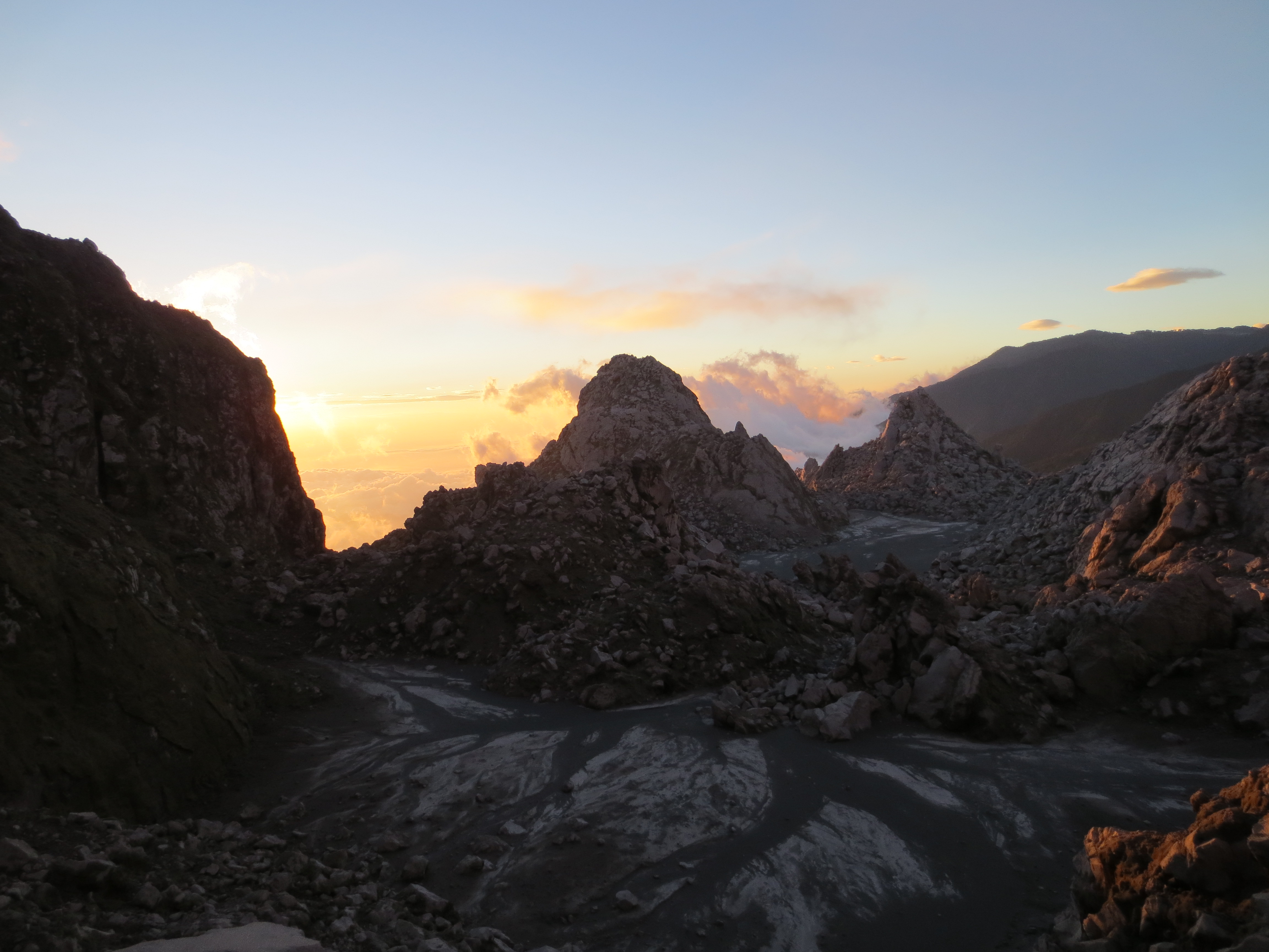
Still wanting to get closer, the guides and I took off once more, but this time the hike had changed to being a true climb. The terrain, as you might expect, was not always stable, and loose rocks made climbing tricky and dangerous. Undeterred and led by my experienced guide, we scaled up and up… the last section was more or less vertical, but once we reached the top there was a flat area, which used to be crater site #3, and about 150 meters in front of us lay the active crater. We waited for a brief period to see an eruption, but not wanting to get stuck op there in the dark we decided to return to camp when all of a sudden…
BOOM! She started to erupt! We grabbed our cameras as gas began spiraling upward. I stood in awe… over 2 years of waiting and extremely good timing had paid off. We celebrated our accomplishment while watching the sunset over the rocky peaks which surrounded us. At night Santiaguito continued erupting and the clearness of the night allowed us to see lots of reds and oranges being shot into the air towards the millions upon millions of stars which we curiously mused over. All in all, an amazing experience.
Supporting a Great Company:
I did this hike with Marvin Laynez and his business partner Martín Diaz. I highly recommend their services, and you can get in contact with them at their website: http://www.guateguides.com/
Bibliography:
1) “Hikes.” To Volcanoes and Mountains in Guatemala. N.p., n.d. Web. 10 Dec. 2013.
http://altiplanos.com.gt/hikes.html#santiaguito
2) “ERUPTION HISTORY.” ERUPTION HISTORY. N.p., n.d. Web. 12 Dec. 2013.
http://www.geo.mtu.edu/volcanoes/santamaria/eruption.html
3) Laynez, Marvin Wilfredo. Personal Conversation with Adventure Guide. 30 Nov. 2013.
I love how you research & have a bibliography… it is very ummm educational? Ha! Either way it was amazing meeting you, and can’t wait to stalk your adventures while I am stuck in the states! You blog keeps making me laugh… it is so honest, I know I just met ya last week, but it makes me feel like I know you! Good luck studying!